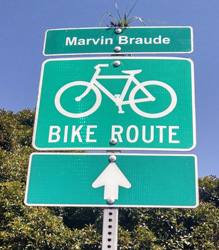
 For our final bike ride of the summer, Amanda and I rode the Marvin Braude Bike Trail from Santa Monica to Redondo Beach. I knew going in that it would be a long ride of more than 40 miles round trip. Fortunately, the terrain is flat since the trail runs along the beach.
Our first three rides of the summer were over 25 miles each, so I figured we had trained sufficiently and were ready for it. Here’s a look at the trail, including the ride profile, how it went for us, and tips I learned for next time.
Accessing the trail
We started at the north end of the trail which begins at Will Rogers State Beach. The beach is located at the intersection of Temescal Canyon and Pacific Coast Highway. For parking, you can either search for free parking along Temescal Canyon, or you can park in the beach lot. I opted to park in the lot so we had plenty of room to maneuver the bikes out of the back of our car.
Riding the trail
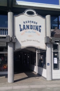
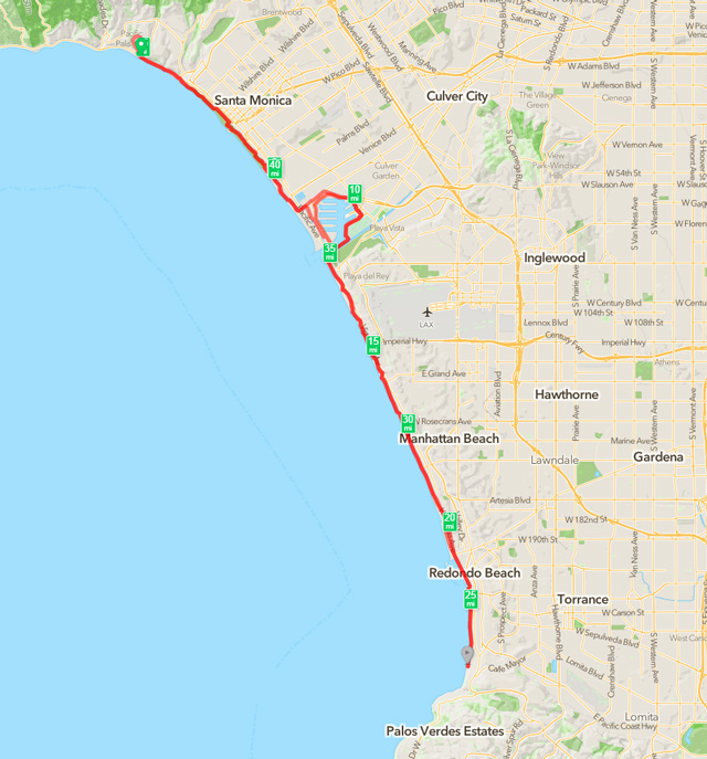
The Marvin Braude bike trail starts at the southern end of Will Rogers State Beach parking lot and heads toward Santa Monica. After passing under the Santa Monica pier, you ride through Venice Beach before taking a slight detour inland to Marina Del Rey. You need to ride about a 1/2 mile along the side of Washington Boulevard before the bike path starts again. After winding through Marina Del Rey, you head back out towards the coast and Dockweiler State Beach. As you ride past Dockweiler, you’ll hear the sounds of airplanes taking off from LAX and experience the thrill of them passing directly overhead. After passing LAX, you go through El Segundo before hitting the beach communities of Manhattan, Hermosa and Redondo Beach. As you ride through Hermosa Beach, you have the option to ride along the beach or Hermosa Ave, where they have a full car lane reserved for bikes. Once you make it to the southern end of Redondo Beach, the path ends at a small snack shop. It’s a good place to rest up and refuel before turning around and retracing the path back north.
With the exception of the short stretches on Washington Boulevard through Venice, Fiji Way in Marina Del Rey, and Hermosa Ave in Hermosa Beach, the bike trail is separate and isolated from vehicle traffic. It makes for a safe and enjoyable ride, provided you are able to safely navigate the other bikers, joggers, dog walkers, roller-bladers, beach-goers, and other pedestrians who share the path with you.
Trail map and profile
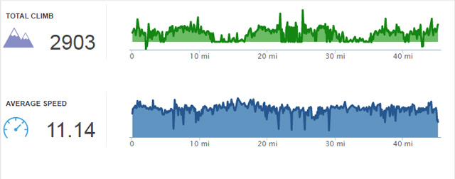
Here is a map overview of the trail, along with the ride profile from RunKeeper. If you like, you can download the official map of the bike path from the LA County site by clicking here.
How the ride went
 For the most part, the ride went really well. Although we added a bit of distance (and time) to the ride by getting lost in Marina Del Rey on the way down, we still made it to Redondo Beach in about two hours. After resting up, drinking water, and having a light snack, we were ready to head back.
The ride was going fine until we passed through 30 miles. At that point, we started to feel it a bit. When we passed mile 35 and my daughter said to me, “we didn’t train properly for this,” I knew we were in a bit of trouble. Even the small climbs at that point were a chore, but we pushed through and made it. I’ll admit that the legs were feeling a bit soft and heavy towards the end. It also didn’t help that we were riding into a slight headwind the whole way back.
You can click here for a look at our mile-by-mile splits. We definitely did a better on our way there than on our way back.
For anyone who bikes regularly, I doubt this is a hard ride. However, for recreational riders on hybrid bikes, it can be a bit more challenging. Despite running out of gas towards the end, I’d still do the ride again – in a heartbeat!
Tips and lessons learned for next time
Here are a few tips and lessons learned that you may want to review before riding the trail. I know I’ll be using these the next time I ride it.
- You’ll want to get to Will Rogers State Beach prior to 9AM. Parking is only $7 prior to 9AM and goes up to $14.50 afterwards. Parking is good all-day, which isn’t all that special since there are no in-and-out privileges.
- The earlier you bike the path the better. We started around 8AM, but I would recommend starting at 7AM or earlier to avoid pedestrian and beach traffic. It got pretty congested on the way back, which was on Saturday morning between 10AM and noon.
- I recommend parking at the south end of the Will Rogers State Beach parking lot. It requires looping around the entrance and going straight (not left to exit). It will cut some mileage off the route, which you will appreciate when you’re coming back. At least that’s the feeling Amanda and I had as we approached the parking lot and wondered why we parked at the north end of the lot.
- When you reach the end of Venice Beach, you will get dumped onto Washington Boulevard. Go straight and stay on Washington for about 1/2 mile until you see the signs for bike trail at Mildred Ave (if you get to Oxford Ave, you’ve went too far). I made the mistake of peeling off Washington too soon onto Via Dolce and got lost looking for the bike path, which added almost 2 miles to our overall ride.
- Pay attention to any signs where it tells you to get off your bike to walk. These will pop up later in the day at both Manhattan and Redondo Beach. If the police are present, you will get fined, which I’ve heard has happened to quite a few people.
- Through Hermosa Beach, we biked along Hermosa Avenue instead of staying on the boardwalk along the beach, aka “The Strand”. You can bike along the beach, but it’s crowded with pedestrians, has areas where you need to walk your bike, and has a posted speed limit of 8 mph, although I don’t know how they enforce it. We rode The Strand for a bit on the ride back before getting frustrated with the traffic and turning back onto Hermosa Ave. During the stretch we biked, I didn’t see any speed traps or cops with radar guns hiding out in the alleyways.
Additional photos from the ride
Panoramic view of Redondo Beach at the end of the trail

Panoramic view of Manhattan Beach looking out towards the pier

There are mile markers scattered along the path, but when you see this one, you’ll have made it to Redondo Beach
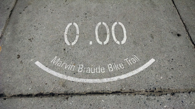
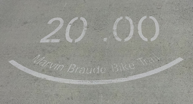
I was really happy I was to see this one on the way back. It marked the end of the ride!
I enjoyed all four rides my daughter and I took this summer and would highly recommend all of them. I’ve included the links to the other three rides below. If I had to pick a favorite, the Marvin Braude Bike Trail would top the list, despite all of the pedestrian and other bike traffic. You just can’t be the views of the beach and the ocean that exist the entire length of the trail.
- No. 1 – The ride to “The Rock”
- No. 2 – The Ventura River and Ojai Valley Trails
- No. 3 – The Pacific Coast Bike Route, Ventura County
So that concludes the rides for the summer. I’d like to continue cycling, but I need to find a new partner (and some new trails). I’m going to see if Lisa will join me on a few rides. She likes to spin, so I’m hoping it won’t be too hard to convince her. Otherwise, I may be stuck waiting until Amanda returns home from school next summer!


Thanks for taking the time to blog about the MB path. Directions for the area thru Marina Del Rey were nice and clear…. exactly what I was looking for. I don’t like riding in traffic, so I wanted to at least have a clear idea where I was going before I attempted it. Also good info on the fatigue factor. Lots of good info about a lot of things, actually.
My pleasure. I’m also not a big fan of riding in traffic, especially around the city streets of LA which contributed to my wrong turn the first time around. Even with the street sections (which are short), this is my favorite ride in Southern California. The scenery along the beach is spectacular!
Pingback: Marvin Braude Trail - redux - Gregg Borodaty
Pingback: 2018 - Year in review for the blog - Gregg Borodaty